Information
| ID: | 10381 |
| IGS type code: | TDAM00USA |
| Latitude: | 29.313919° |
| Longitude: | -94.817002° |
| Ellipsoidal Height: | -2.903 m |
| Ellipsoidal Height Epoch: | 2023.0000 |
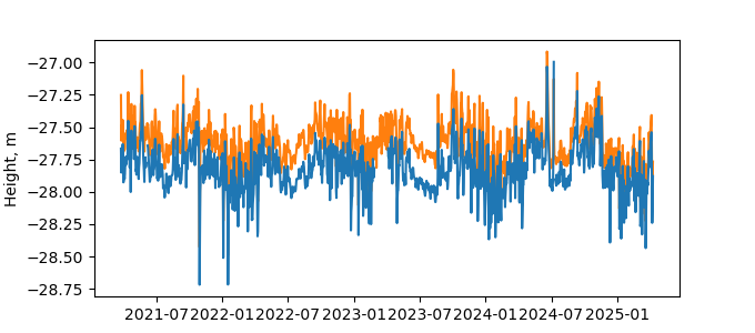
| Reflector Height: | 24.979 m |
| Provider: | UNAVCO |
| Alternative Providers: | |
| SONEL Link: | |
| NGL Link: |
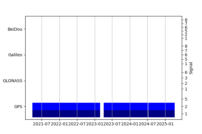
| GNSS Receiver | |
| Mask used |
Data
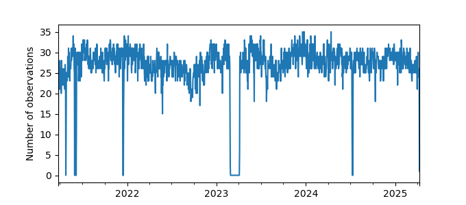
Zipped data filePlot of daily data
Inventory
Additional Data Sources from tide gauges (guide to additional data sources)
Monthly Mean Data from PSMSL: 161Nearby Real Time Stations from VLIZ: gptx
Fast Delivery Data from UHSLC: 775


