Information
| ID: | 10403 |
| IGS type code: | EITO00DEU |
| Latitude: | 54.314685° |
| Longitude: | 8.950093° |
| Ellipsoidal Height: | 45.695 m |
| Ellipsoidal Height Epoch: | 2023.0000 |
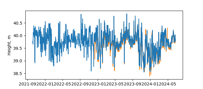
| Reflector Height: | 6.077 m |
| Provider: | BAFG |
| Alternative Providers: | |
| SONEL Link: | |
| NGL Link: | EITO |
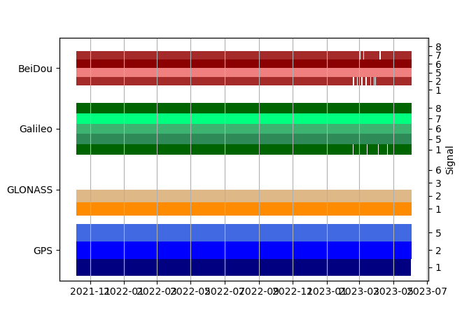
| GNSS Receiver | |
| Mask used |
Data
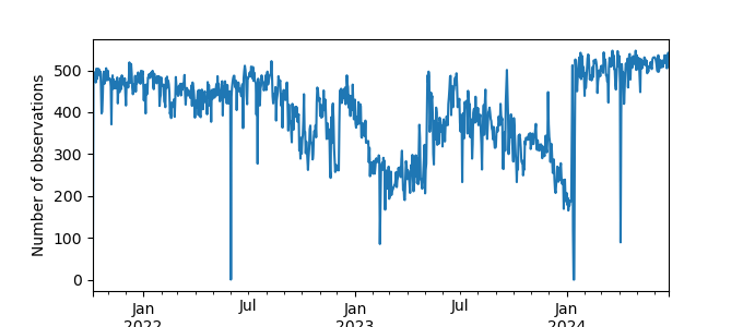
Zipped data filePlot of daily data
Inventory
Additional Data Sources from tide gauges (guide to additional data sources)


