Information
| ID: | 10416 |
| IGS type code: | N00300USA |
| Latitude: | 32.034672° |
| Longitude: | -80.903052° |
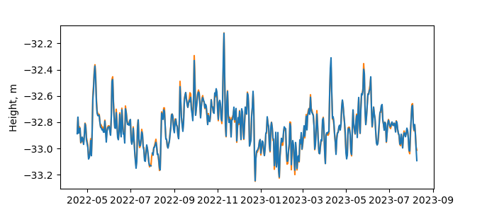
| Ellipsoidal Height: | -26.462 m |
| Ellipsoidal Height Epoch: | 2023.0000 |
| Reflector Height: | 6.473 m |
| Provider: | NGS |
| Alternative Providers: | |
| SONEL Link: | N00300USA |
| NGL Link: | N003 |
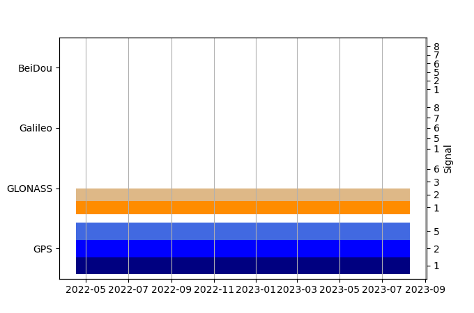
| GNSS Receiver | |
| Mask used |
Data
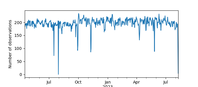
Zipped data filePlot of daily data
Inventory
Additional Data Sources from tide gauges (guide to additional data sources)
Monthly Mean Data from PSMSL: 351Fast Delivery Data from UHSLC: 752


