Information
| ID: | 10419 |
| IGS type code: | ROPS00USA |
| Latitude: | 29.515697° |
| Longitude: | -94.510589° |
| Ellipsoidal Height: | -20.746 m |
| Ellipsoidal Height Epoch: | 2024.0000 |
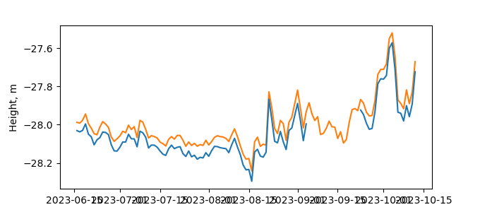
| Reflector Height: | 7.320 m |
| Provider: | NGS CORS |
| Alternative Providers: | |
| SONEL Link: | ROPS00USA |
| NGL Link: |
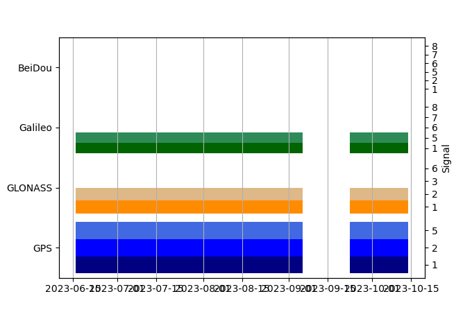
| GNSS Receiver | |
| Mask used |
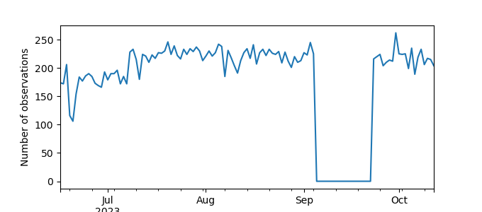
Data
Zipped data filePlot of daily data
Inventory
Additional Data Sources from tide gauges (guide to additional data sources)


