Information
| ID: | 10448 |
| IGS type code: | SOLU00NOR |
| Latitude: | 59.710600° |
| Longitude: | 10.273000° |
| Ellipsoidal Height: | 45.489 m |
| Ellipsoidal Height Epoch: | 2025.0000 |
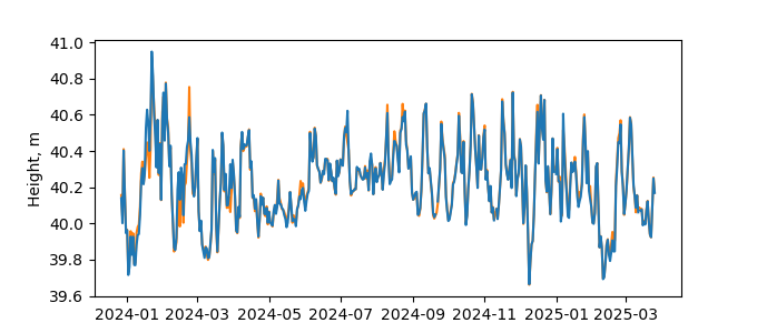
| Reflector Height: | 5.417 m |
| Provider: | SONEL |
| Alternative Providers: | |
| SONEL Link: | SOLU00NOR |
| NGL Link: |
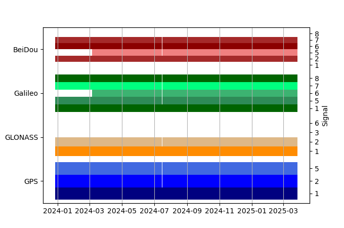
| GNSS Receiver | |
| Mask used |
Data
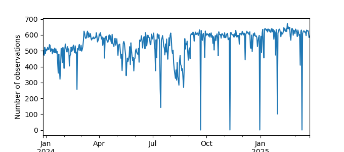
Zipped data filePlot of daily data
Inventory
Additional Data Sources from tide gauges (guide to additional data sources)


