Information
| ID: | 10456 |
| IGS type code: | LOCG00GBR |
| Latitude: | 56.013532° |
| Longitude: | -5.446065° |
| Ellipsoidal Height: | 71.935 m |
| Ellipsoidal Height Epoch: | 2023.0000 |
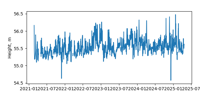
| Reflector Height: | 16.491 m |
| Provider: | OS |
| Alternative Providers: | EPOS EU |
| SONEL Link: | |
| NGL Link: | LOCG |
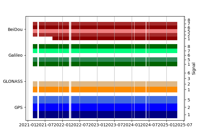
| GNSS Receiver | |
| Mask used |
Data
Zipped data filePlot of daily data
Inventory
Additional Data Sources from tide gauges (guide to additional data sources)


