Information
| ID: | 10460 |
| IGS type code: | HONF00FRA |
| Latitude: | 49.427932° |
| Longitude: | 0.230301° |
| Ellipsoidal Height: | 60.176 m |
| Ellipsoidal Height Epoch: | 2024.0000 |
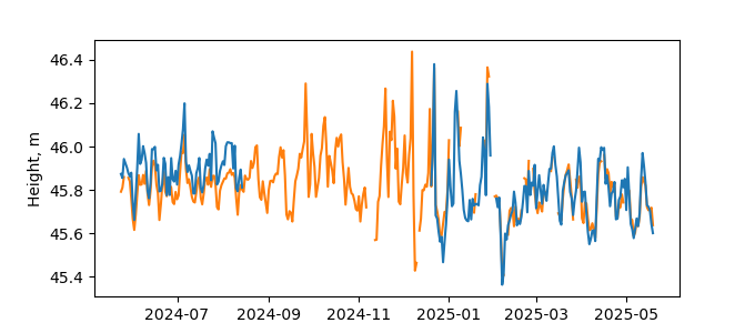
| Reflector Height: | 14.471 m |
| Provider: | RGP |
| Alternative Providers: | |
| SONEL Link: | |
| NGL Link: |
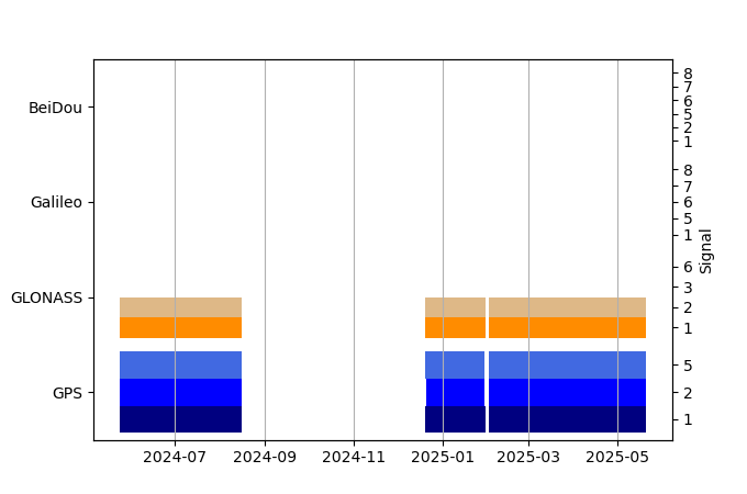
| GNSS Receiver | |
| Mask used |
Data
Zipped data filePlot of daily data
Inventory
Additional Data Sources from tide gauges (guide to additional data sources)


