Information
| ID: | 10472 |
| IGS type code: | LRSK00GRL |
| Latitude: | 71.186788° |
| Longitude: | -52.239568° |
| Ellipsoidal Height: | 224.968 m |
| Ellipsoidal Height Epoch: | 2025.0000 |
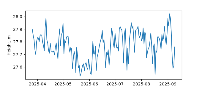
| Reflector Height: | 197.287 m |
| Provider: | UNAVCO |
| Alternative Providers: | |
| SONEL Link: | |
| NGL Link: |
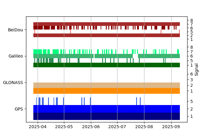
| GNSS Receiver | |
| Mask used |
Data
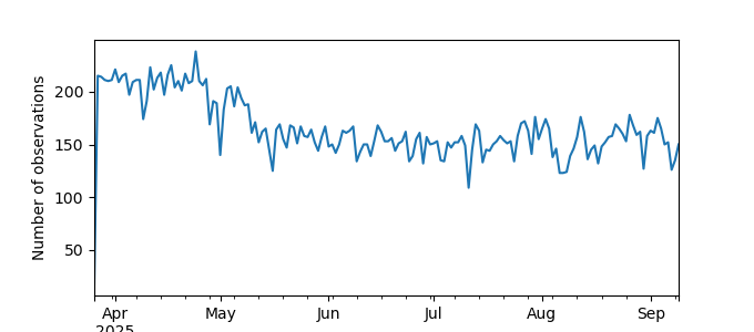
Zipped data filePlot of daily data
Inventory
Additional Data Sources from tide gauges (guide to additional data sources)


