Information
| ID: | 10479 |
| IGS type code: | PENP00GBR |
| Latitude: | 51.434819° |
| Longitude: | -3.164853° |
| Ellipsoidal Height: | 65.108 m |
| Ellipsoidal Height Epoch: | 2025.0000 |
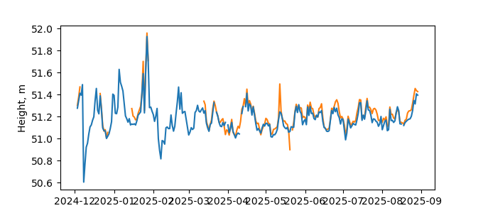
| Reflector Height: | 13.916 m |
| Provider: | NOC |
| Alternative Providers: | |
| SONEL Link: | |
| NGL Link: |
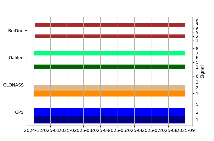
| GNSS Receiver | |
| Mask used |
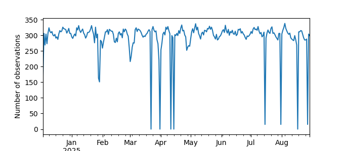
Data
Zipped data filePlot of daily data
Inventory
Additional Data Sources from tide gauges (guide to additional data sources)


