MODELLING SHORELINE EVOLUTION ASSOCIATED WITH EARTH GLACIATION
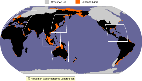
The aim of this website is to illustrate the changes in the Earth's shorelines during the past 20 kyr caused by the deglaciation of the Late Pleistocene ice sheets. Maps of palaeotopography at 1 kyr intervals during this period can be accessed by clicking on one of the five regions highlighted below. These maps are based on predictions generated from a model of glaciation-induced sea-level change and so there will be a certain degree of inaccuracy that will vary from location to location (follow the link Scientific Background for more information). All of the maps can be freely downloaded for non-commercial use, with copyright being held by Proudman Oceanographic Laboratories and the Universities of Durham and Toronto. Please see links below for more information.
CLICK ON AN AREA BELOW TO ACCESS MAPS