Information
| ID: | 10055 |
| IGS type code: | SWTG00GBR |
| Latitude: | 58.207587° |
| Longitude: | -6.388945° |
| Ellipsoidal Height: | 62.084 m |
| Ellipsoidal Height Epoch: | 2018.0000 |
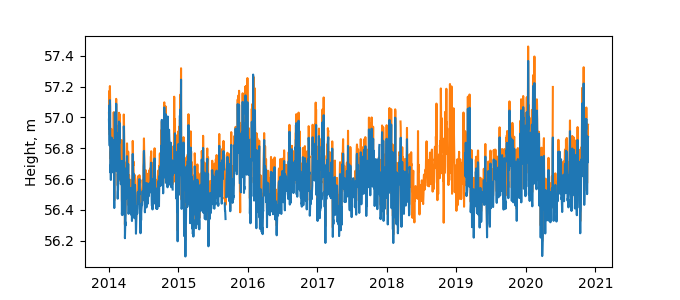
| Reflector Height: | 5.640 m |
| Provider: | BIGF |
| Alternative Providers: | |
| SONEL Link: | SWTG00GBR |
| NGL Link: |
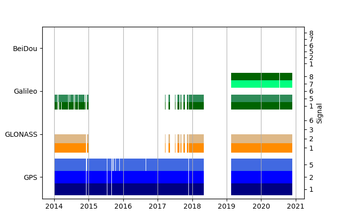
| GNSS Receiver | |
| Mask used |
Data
Zipped data filePlot of daily data
Inventory

Additional Data Sources from tide gauges (guide to additional data sources)
Monthly Mean Data from PSMSL: 314Nearby Real Time Stations from VLIZ: stor
Fast Delivery Data from UHSLC: 295


