Information
| ID: | 10085 |
| IGS type code: | DUNT00NZL |
| Latitude: | -45.814310° |
| Longitude: | 170.629400° |
| Ellipsoidal Height: | 13.448 m |
| Ellipsoidal Height Epoch: | 2012.0000 |
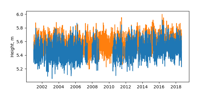
| Reflector Height: | 8.130 m |
| Provider: | Geoscience Australia |
| Alternative Providers: | SONEL |
| SONEL Link: | DUNT00NZL |
| NGL Link: |
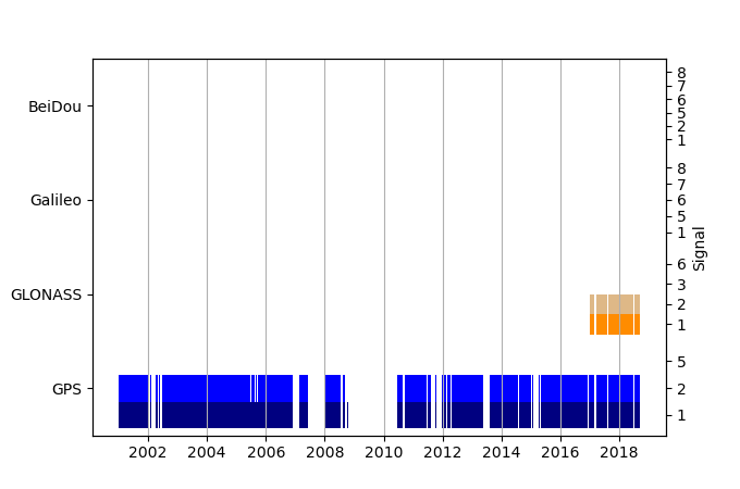
| GNSS Receiver | |
| Mask used |
Data
Zipped data filePlot of daily data
Inventory
Additional Data Sources from tide gauges (guide to additional data sources)
Monthly Mean Data from PSMSL: 1643Nearby Real Time Stations from VLIZ: otat
Research Quality Data from UHSLC: 669a


