Information
| ID: | 10326 |
| IGS type code: | OWMG00NZL |
| Latitude: | -44.024293° |
| Longitude: | -176.368804° |
| Ellipsoidal Height: | 23.654 m |
| Ellipsoidal Height Epoch: | 2021.0000 |
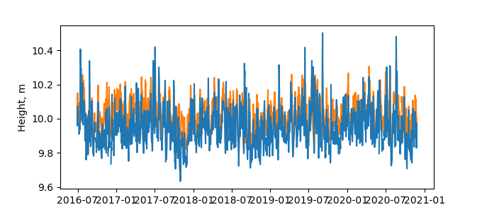
| Reflector Height: | 13.858 m |
| Provider: | BKG |
| Alternative Providers: | UNAVCO |
| SONEL Link: | OWMG00NZL |
| NGL Link: |
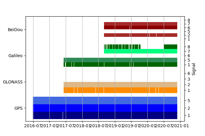
| GNSS Receiver | |
| Mask used |
Data
Zipped data filePlot of daily data
Inventory
Additional Data Sources from tide gauges (guide to additional data sources)
Monthly Mean Data from PSMSL: 1920Nearby Real Time Stations from VLIZ: chit
Fast Delivery Data from UHSLC: 079


