Information
| ID: | 10367 |
| IGS type code: | SHRN00GBR |
| Latitude: | 51.445710° |
| Longitude: | 0.743369° |
| Ellipsoidal Height: | 53.767 m |
| Ellipsoidal Height Epoch: | 2023.0000 |
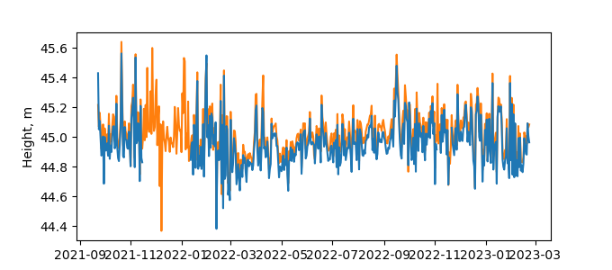
| Reflector Height: | 8.921 m |
| Provider: | SONEL |
| Alternative Providers: | BIGF |
| SONEL Link: | SHRN00GBR |
| NGL Link: |
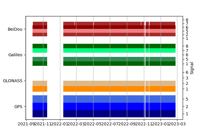
| GNSS Receiver | |
| Mask used |
Data
Zipped data filePlot of daily data
Inventory
Additional Data Sources from tide gauges (guide to additional data sources)
Monthly Mean Data from PSMSL: 3

