Manzanillo, Col.
Station Information
| Station ID: |
163 |
| Latitude: |
19.05 |
| Longitude: |
-104.333 |
| Country: |
MEXICO |
| Time span of data: |
1953 – 1998 |
| Green Arrow: |
Current Station |
Yellow Marker: |
Nearby Station |
Data Availability
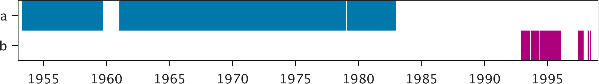
Tide Gauge Data
| Record |
Latitude |
Longitude |
Start date |
End date |
Supplier |
Data |
| a | 19.0533 | -104.33 | 1953-05-01 | 1982-12-31 | 1 | Download |
| b | 19.05 | -104.3333 | 1992-12-01 | 1998-06-09 | 2 | Download |
Data Suppliers
- Servicio Mareografico Nacional
Instituto de Geofisica, Ciudad Universitaria
Delegacion de Coyoacan
04510 Mexico D.F.
MEXICO
- University of Hawaii
Department of Oceanography Division of Natural Sciences
1000 Pope Road
Honolulu
Hawaii 96822
UNITED STATES

