Data
- Obtaining
- Supplying
- High-Frequency
- Bottom Pressure Records
- Other Long Records
- GLOSS/ODINAFRICA Calibration Data
Donate
Donate to PSMSL
Data Notes
- Individual Station Data and Plot Notes
- Referencing the Data Set
- PSMSL Help File
- 2010 Changes to the PSMSL Data Files
Extracted from Database
13 Jul 2026
WARNING: QCFLAG EXISTS. PLEASE READ THE DOCUMENTATION.
Station Information
| Station ID: | 1002 |
| Latitude: | 22.983333 |
| Longitude: | 88.4 |
| Coastline code: | 500 |
| Station code: | 161 |
| Country: | INDIA |
| Time span of data: | 1962 – 2006 |
| Completeness (%): | 98 |
| Date of last update: | 16 Dec 2008 |
| Green Arrow: | Current Station |
| Yellow Marker: | Neighbouring RLR Station |
| Red Marker: | Neighbouring Metric Station |
Please note: In many cases, the station position in our database is accurate to only one minute. Thus, the tide gauge may not appear to be on the coast.
Tide Gauge Data
Station Documentation
Link to RLR information.Documentation added 1993-03-17
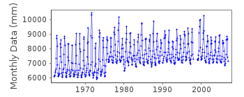
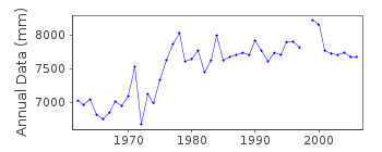
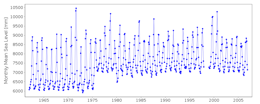
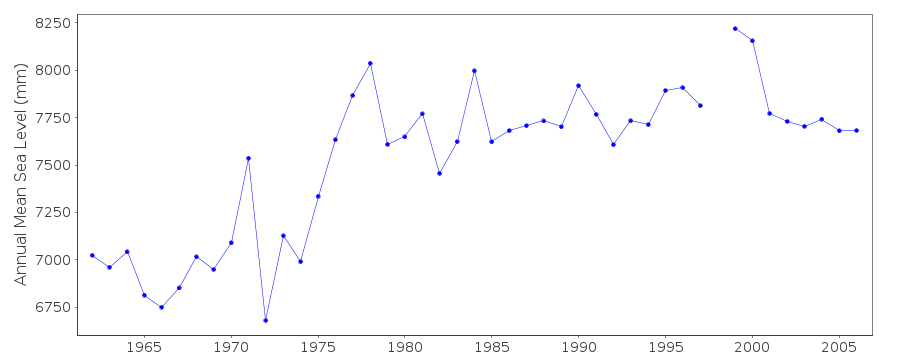
Probable datum shift in mid-1970s in RLR record.Documentation added 1993-07-12
Tribeni 500/161 RLR(1964) is 10.3m below BM80/1Documentation added 1994-08-04
For a discussion of interannual variability of sea level along the coasts of Pakistan and India, see Clarke and Liu, Journal of Physical Oceanography, 24, 1224, 1994.Documentation added 2002-12-06
SMRC Newsletter Jul-Dec 2001 reports high E coast correlation with SOI and MSL. MSL is much higher during La Nina tropical cyclones than during El Nino.Data Authority
Survey of IndiaGeodetic and Research Branch
17 E.C. Road
Dehra Dun
PIN 248 001

![]()
![]()
![]()
