Data
- Obtaining
- Supplying
- High-Frequency
- Bottom Pressure Records
- Other Long Records
- GLOSS/ODINAFRICA Calibration Data
Donate
Donate to PSMSL
Data Notes
- Individual Station Data and Plot Notes
- Referencing the Data Set
- PSMSL Help File
- 2010 Changes to the PSMSL Data Files
Extracted from Database
13 Jul 2026
Station Information
| Station ID: | 1087 |
| Latitude: | 39.55 |
| Longitude: | 2.62 |
| Coastline code: | 225 |
| Station code: | 1 |
| Country: | SPAIN |
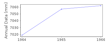
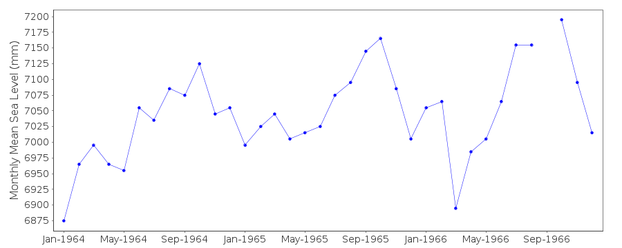
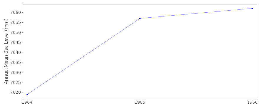
| Time span of data: | 1964 – 1966 |
| Completeness (%): | 97 |
| Link to ellipsoid: | Available |
| Date of last update: | 22 Jun 2011 |
| Green Arrow: | Current Station |
| Yellow Marker: | Neighbouring RLR Station |
| Red Marker: | Neighbouring Metric Station |
Please note: In many cases, the station position in our database is accurate to only one minute. Thus, the tide gauge may not appear to be on the coast.
Tide Gauge Data

Additional Data Sources (guide to additional data sources)
Nearby GNSS Stations from SONEL: MAL1, MALLNearby Real Time Stations from VLIZ: palm
Station Documentation
Link to RLR information.Documentation added 2010-08-17
Station created RLR. RLR year=1964. RLR factor is 6.165m. RLR (1964) is 9.0mbelow TGBM BM. For some reason this was not listed as an RLR station and only
came to light when the new database was being implemented.
This is an hisroric station last data 1966
Data Authority
Instituto Español de OceanografíaCorazón de María, 8
28002, Madrid

![]()
![]()
![]()
