Data
- Obtaining
- Supplying
- High-Frequency
- Bottom Pressure Records
- Other Long Records
- GLOSS/ODINAFRICA Calibration Data
Donate
Donate to PSMSL
Data Notes
- Individual Station Data and Plot Notes
- Referencing the Data Set
- PSMSL Help File
- 2010 Changes to the PSMSL Data Files
Extracted from Database
13 Jul 2026
Station Information
| Station ID: | 1155 |
| Latitude: | 34.747222 |
| Longitude: | 127.765556 |
| Coastline code: | 620 |
| Station code: | 36 |
| Country: | KOREA, REPUBLIC OF |
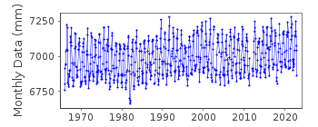
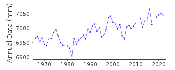
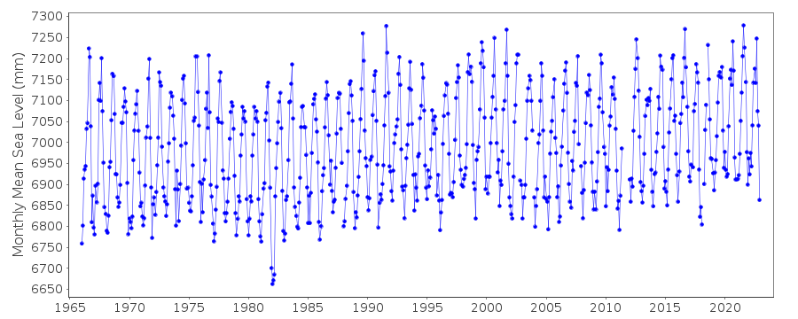
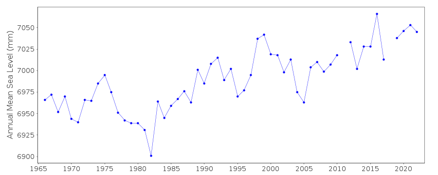
| Time span of data: | 1966 – 2024 |
| Completeness (%): | 100 |
| Date of last update: | 10 Apr 2026 |
| Green Arrow: | Current Station |
| Yellow Marker: | Neighbouring RLR Station |
| Red Marker: | Neighbouring Metric Station |
Please note: In many cases, the station position in our database is accurate to only one minute. Thus, the tide gauge may not appear to be on the coast.
Tide Gauge Data
Station Documentation
Link to RLR information.Documentation added 1991-06-11
Yosu 620/036 RLR(1966) is 11.1m below TBM No2Documentation added 2012-07-30
At the request of the data supplier, KHOA the name of this station has beenchanged to Yeosu. The values for lat. and long, have also been revised.
Tide gauge is a MIROS radar gauge
Documentation added 2012-08-15
When preparing the RLR diagram to be displayed on the PSMSL website it wasnoted that the data for 1966-1969 was not RLR. There are no problems with
the data for this period so the whole dataset 1966 onwards is now RLR.
Documentation added 2026-04-16
Updated the entire dataset to L2 dataset to ensure users can access fully quality-controlled sea level data for long-term variability and trend analysis.Data Authority
Korea Hydrographic and Oceanographic Agency (KHOA)351, Haeyang-ro
Yeongdo-gu
Busan
Republic of Korea
Documentation added 2000-10-11
The National Oceanographic Research Institute of Korea wasformerly (pre late-1990s) the Office of Hydrographic Affairs
(same address).
Documentation added 2018-05-17
KHOA was formerly the National Oceanographic Research Institute

![]()
![]()
![]()
