Data
- Obtaining
- Supplying
- High-Frequency
- Bottom Pressure Records
- Other Long Records
- GLOSS/ODINAFRICA Calibration Data
Donate
Donate to PSMSL
Data Notes
- Individual Station Data and Plot Notes
- Referencing the Data Set
- PSMSL Help File
- 2010 Changes to the PSMSL Data Files
Extracted from Database
13 Jul 2026
Station Information
| Station ID: | 118 |
| Latitude: | 55.7 |
| Longitude: | 21.133333 |
| Coastline code: | 84 |
| Station code: | 161 |
| Country: | LITHUANIA |
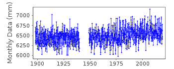
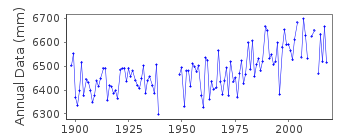
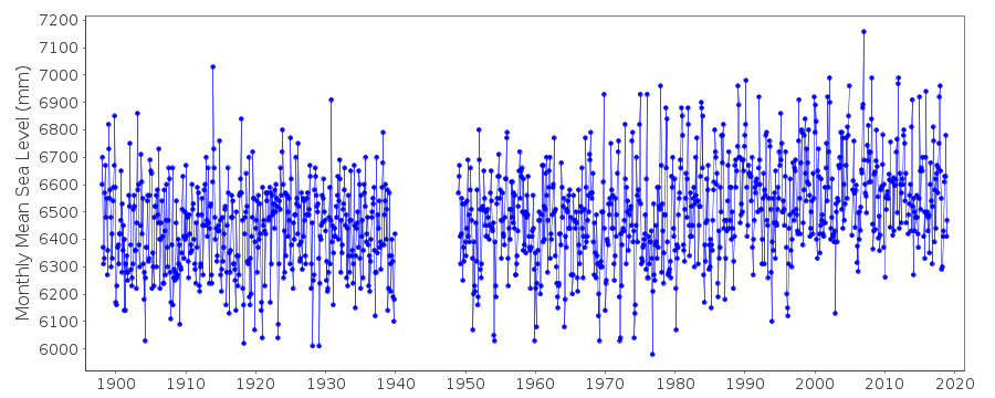
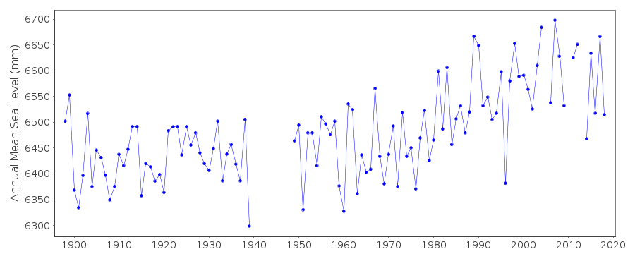
| Time span of data: | 1898 – 2018 |
| Completeness (%): | 92 |
| Link to ellipsoid: | Available |
| Date of last update: | 23 Jul 2019 |
| Green Arrow: | Current Station |
| Yellow Marker: | Neighbouring RLR Station |
| Red Marker: | Neighbouring Metric Station |
Please note: In many cases, the station position in our database is accurate to only one minute. Thus, the tide gauge may not appear to be on the coast.
Tide Gauge Data
Station Documentation
Link to RLR information.Documentation added 1991-06-11
Klaipeda 080/161 RLR(1938) is 10.0m below BM1000Documentation added 1994-07-11
This station is in Lithuania (old name Memel - see 080/171)Documentation added 2009-03-16
Previously held data for station Klaipeda was just 1937-1938. This data updated using data supplied 1898-2008 some gaps in the data.Documentation added 2009-03-16
Gap in data 1940-1949. Datum of the full dataset is Normaal Amsterdams Peils (NAP).Documentation added 2016-01-22
We removed the initial line of the documentation stating "1937 READINGS BASED ON VALUES OF HIGH AND LOW WATERS". As the documentation from 16-Mar-2009 states, this data had been replaced with MSL data.Data Authority
Geodetic InstituteVilnius Gediminas Technical University
Sauletekio Al. 11
LT-2040 Vilnius

![]()
![]()
![]()
