Data
- Obtaining
- Supplying
- High-Frequency
- Bottom Pressure Records
- Other Long Records
- GLOSS/ODINAFRICA Calibration Data
Donate
Donate to PSMSL
Data Notes
- Individual Station Data and Plot Notes
- Referencing the Data Set
- PSMSL Help File
- 2010 Changes to the PSMSL Data Files
Extracted from Database
13 Jul 2026
Station Information
| Station ID: | 1243 |
| Latitude: | 36.441717 |
| Longitude: | 28.236439 |
| Coastline code: | 290 |
| Station code: | 110 |
| Country: | GREECE |
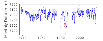
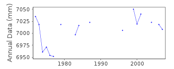
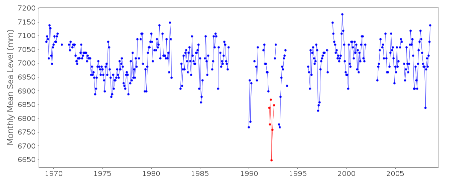
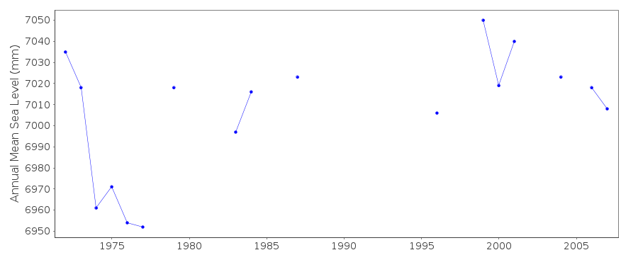
| Time span of data: | 1969 – 2008 |
| Completeness (%): | 71 |
| Date of last update: | 07 Aug 2013 |
| Green Arrow: | Current Station |
| Yellow Marker: | Neighbouring RLR Station |
| Red Marker: | Neighbouring Metric Station |
Please note: In many cases, the station position in our database is accurate to only one minute. Thus, the tide gauge may not appear to be on the coast.
Tide Gauge Data
Station Documentation
Link to RLR information.Documentation - date unknown
1969-1980 Data from readings of tide poleDocumentation added 1997-03-11
The contributing authority advises that anomalous valuesare the result of met. influences
Documentation added 2011-02-15
During 2003 the method of recording the sea level at Rodhos was changed fromrecording downwards to the more conventional recording upwards. The elevation
relevant to benchmark R 4 is now 1.916m giving a revised RLR factor of 6.484m.
Data points Feb - Aug 1992 flagged as the data looks anomalous when buddy
checked with data for Leros. Although Leros is a way away the sea level
profiles are in the main comparable.
Documentation added 2013-03-14
Following receipt of datum diagrams from the Hellenic Navy the RLR diagram has been re-drawn. In consequence both the RLR factors and the benchmark reference have changed.Rhodos tide gauge was moved in November 2009. This station has been superceded
by Rhodos II id. 2167
Documentation added 2014-08-11
Two of the older benchmarks have been added to the RLR diagram R4 0.316m above the old datum and W2 3.211m above the new datum.Data Authority
Hellenic Navy Hydrographic ServiceGeographic Policy and International Relations Office
TGN 1040
Athens

![]()
![]()
![]()
