Data
- Obtaining
- Supplying
- High-Frequency
- Bottom Pressure Records
- Other Long Records
- GLOSS/ODINAFRICA Calibration Data
Donate
Donate to PSMSL
Data Notes
- Individual Station Data and Plot Notes
- Referencing the Data Set
- PSMSL Help File
- 2010 Changes to the PSMSL Data Files
Extracted from Database
13 Jul 2026
Station Information
| Station ID: | 1350 |
| Latitude: | 60.683333 |
| Longitude: | -151.396667 |
| Coastline code: | 821 |
| Station code: | 13 |
| Country: | UNITED STATES |
| Time span of data: | 1973 – 2025 |
| Completeness (%): | 58 |
| Date of last update: | 28 Jan 2026 |
| Green Arrow: | Current Station |
| Yellow Marker: | Neighbouring RLR Station |
| Red Marker: | Neighbouring Metric Station |
Please note: In many cases, the station position in our database is accurate to only one minute. Thus, the tide gauge may not appear to be on the coast.
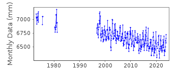
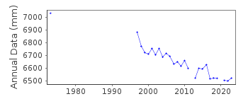
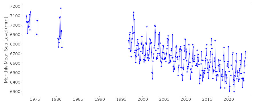
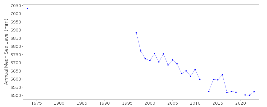
Tide Gauge Data
Additional Data Sources (guide to additional data sources)
Nearby GNSS Stations from SONEL: KEN1, KEN5Station Documentation
Link to RLR information.Documentation added 1991-06-11
Nikiski 821/013 RLR(1973) is 14.4m below BM#5Documentation added 1992-04-02
SOUTH ALASKAN COASTLINE EARTHQUAKE PRONE - E.G. MAGNITUDE 9.2 EARTHQUAKE OF 28 MARCH 1964 - SEE SAVAGE AND PLAFKER, JGR, 96(B3), 4325-4335, 1991Documentation added 2009-01-28
Treat early data as suspect.Documentation added 2011-12-20
Using NOAA data the RLR diagram has been revised.Previous Primary benchmark BM #5 13.228m above gauge datum no longer features in the NOAA reports. Current Primary benchmark is 5760 L 1983 14.85m above gauge datum.Data Authority
N.O.A.A. / N.O.S.N/oes33, Ssmc4, Room 6531
1305 East-West Highway
Silver Spring,
MD 20910

![]()
![]()
![]()
