Data
- Obtaining
- Supplying
- High-Frequency
- Bottom Pressure Records
- Other Long Records
- GLOSS/ODINAFRICA Calibration Data
Donate
Donate to PSMSL
Data Notes
- Individual Station Data and Plot Notes
- Referencing the Data Set
- PSMSL Help File
- 2010 Changes to the PSMSL Data Files
Extracted from Database
20 Jul 2026
Station Information
| Station ID: | 1706 |
| Latitude: | 43.133333 |
| Longitude: | 17.2 |
| Coastline code: | 280 |
| Station code: | 46 |
| Country: | CROATIA |
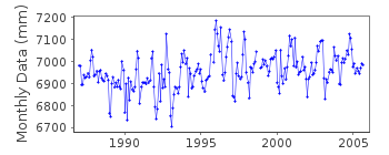
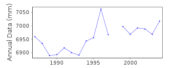
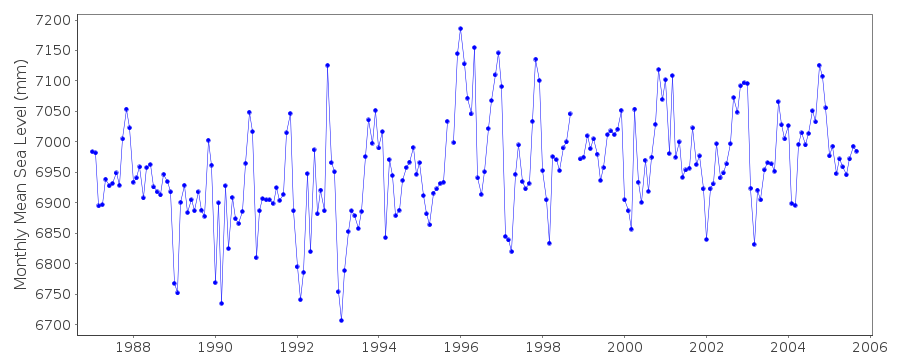
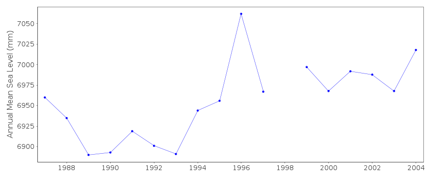
| Time span of data: | 1987 – 2005 |
| Completeness (%): | 97 |
| Date of last update: | 12 May 2008 |
| Green Arrow: | Current Station |
| Yellow Marker: | Neighbouring RLR Station |
| Red Marker: | Neighbouring Metric Station |
Please note: In many cases, the station position in our database is accurate to only one minute. Thus, the tide gauge may not appear to be on the coast.
Tide Gauge Data
Station Documentation
Link to RLR information.Documentation added 1991-06-11
Sucuraj 280/046 RLR(1987) is 9.7m below BMDocumentation added 1992-03-04
Prior to 1990 data supplied by Hidrografski Institut, SplitDocumentation added 1996-01-12
Tide gauge of the State Hydrographic Institute at SplitDocumentation added 1996-01-12
gauge=FuessDocumentation added 2009-11-26
The tide gauge at Sucurje has been replace by one in Ploce. Last data for Sucurje is 2005. See letter of confirmation Feb.2009.Data Authority
Hidrografski Institut of Rep. of CroatiaZrinsko-Frankopanska 161
21000 Split

![]()
![]()
![]()
