Data
- Obtaining
- Supplying
- High-Frequency
- Bottom Pressure Records
- Other Long Records
- GLOSS/ODINAFRICA Calibration Data
Donate
Donate to PSMSL
Data Notes
- Individual Station Data and Plot Notes
- Referencing the Data Set
- PSMSL Help File
- 2010 Changes to the PSMSL Data Files
Extracted from Database
13 Jul 2026
Station Information
| Station ID: | 1715 |
| Latitude: | 30.325 |
| Longitude: | -89.325 |
| Coastline code: | 940 |
| Station code: | 36 |
| Country: | UNITED STATES |
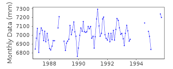
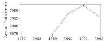
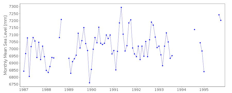
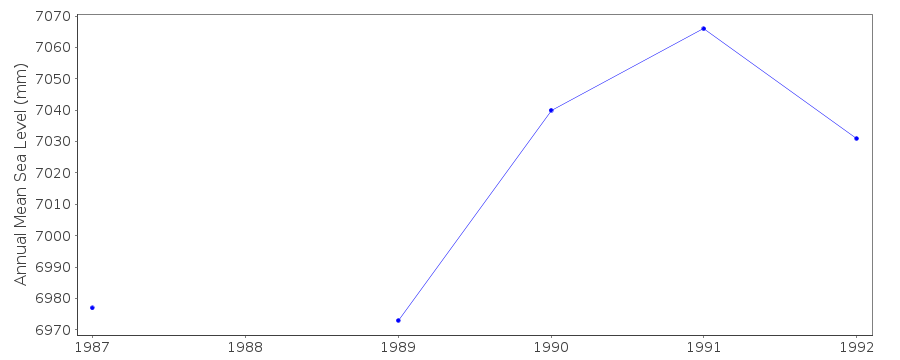
| Time span of data: | 1987 – 1995 |
| Completeness (%): | 75 |
| Date of last update: | 01 Oct 1996 |
| Green Arrow: | Current Station |
| Yellow Marker: | Neighbouring RLR Station |
| Red Marker: | Neighbouring Metric Station |
Please note: In many cases, the station position in our database is accurate to only one minute. Thus, the tide gauge may not appear to be on the coast.
Tide Gauge Data
Additional Data Sources (guide to additional data sources)
Nearby Real Time Stations from VLIZ: wlms2, wlmsStation Documentation
Link to RLR information.Documentation added 1993-07-08
Bay Waveland Yacht Club 940/036 RLR(1987) is 7.9m below BM 7437 ADocumentation added 1993-07-12
Bay Waveland Y.C. 940/036 RLR(1987) is 7.9m below BM 7437 ADocumentation added 1993-07-29
Many stations on the Gulf coast have large values for September 1961.Documentation added 2012-02-09
Station Bay Waveland Yacht Club is an Historic station. Last data was that for1995. This station is still included on the NOAA website as one of the Historic
data sites. Primary benchmark is listed as NO 1 1968 2.473m above TGZ. This
benchmark does not appear on the original RLR diagram. Benchmark on the
original diagram was 7437 A 1978 1.871m above TGZ. This benchmark still appears
on the NOAA benchmark sheet for this station.
Data Authority
N.O.A.A. / N.O.S.N/oes33, Ssmc4, Room 6531
1305 East-West Highway
Silver Spring,
MD 20910

![]()
![]()
![]()
