Data
- Obtaining
- Supplying
- High-Frequency
- Bottom Pressure Records
- Other Long Records
- GLOSS/ODINAFRICA Calibration Data
Donate
Donate to PSMSL
Data Notes
- Individual Station Data and Plot Notes
- Referencing the Data Set
- PSMSL Help File
- 2010 Changes to the PSMSL Data Files
Extracted from Database
13 Jul 2026
Station Information
| Station ID: | 1719 |
| Latitude: | 54.7 |
| Longitude: | 20.483333 |
| Coastline code: | 80 |
| Station code: | 179 |
| Country: | RUSSIAN FEDERATION |
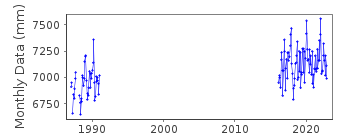
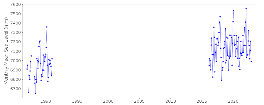
| Time span of data: | 1987 – 2024 |
| Completeness (%): | 32 |
| Date of last update: | 20 Oct 2025 |
| Green Arrow: | Current Station |
| Yellow Marker: | Neighbouring RLR Station |
| Red Marker: | Neighbouring Metric Station |
Please note: In many cases, the station position in our database is accurate to only one minute. Thus, the tide gauge may not appear to be on the coast.
Tide Gauge Data

Station Documentation
Link to RLR information.Documentation added 1991-06-11
Pionersky 080/179 RLR(1989) is 9.4m below BMDocumentation added 1993-07-12
Pionersky 080/179 RLR(1989) is 9.4m below BMDocumentation added 1995-01-20
This station is in Russia.Documentation added 1995-07-19
No observations made 1992-93Documentation added 1996-01-25
no data for 1994 - gauge malfunctionDocumentation added 1996-02-28
no data for 1995 - gauge malfunctionDocumentation added 1999-08-19
no observations conducted at this site because the tide gauge andlevel rod have been damaged
Documentation added 2002-05-21
Pionersky confirmed as malfunctioned, probably in 1991;Documentation added 2003-05-29
No data in 2002 due to malfunctioning gauge.Documentation added 2018-01-16
This station was previously called Pionersky. However the World Data Center (WDC) have confirmed this postion refers to Kalininglad.A new tide gauge has been installed on the site of the old tide gauge. Data begins March 2016.
Data Authority
World Data CenterRussian Federal Service for Hydrometeorology
and Environmental Monitoring
6 Korolev Street, 249035 Obninsk
Kaluga Region

![]()
![]()
![]()
