Data
- Obtaining
- Supplying
- High-Frequency
- Bottom Pressure Records
- Other Long Records
- GLOSS/ODINAFRICA Calibration Data
Donate
Donate to PSMSL
Data Notes
- Individual Station Data and Plot Notes
- Referencing the Data Set
- PSMSL Help File
- 2010 Changes to the PSMSL Data Files
Extracted from Database
13 Jul 2026
Station Information
| Station ID: | 1763 |
| Latitude: | -77.03392 |
| Longitude: | 163.19123 |
| Coastline code: | 999 |
| Station code: | 70 |
| Country: | ANTARCTICA |
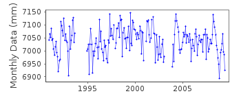
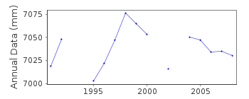
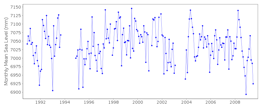
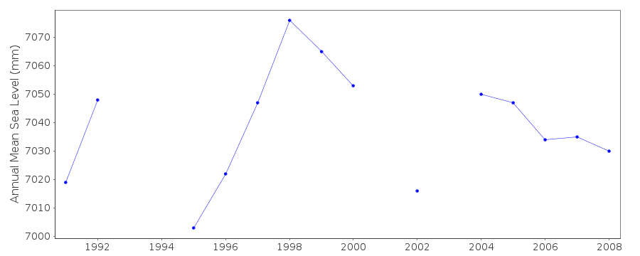
| Time span of data: | 1990 – 2009 |
| Completeness (%): | 82 |
| Date of last update: | 27 Sep 2010 |
| Green Arrow: | Current Station |
| Yellow Marker: | Neighbouring RLR Station |
| Red Marker: | Neighbouring Metric Station |
Please note: In many cases, the station position in our database is accurate to only one minute. Thus, the tide gauge may not appear to be on the coast.
Tide Gauge Data
Station Documentation
Link to RLR information.Documentation added 2008-10-01
Dataset for Cape Roberts Antarctica 1990-2007 received from Glen Rowe at LINZ. This is a new station to PSMSL.Documentation added 2009-10-07
Antarctica station Cape Roberts is now an RLR station. RLR value=0.785Documentation added 2011-11-17
There is no data available for 2010. Although the site is still working the data is of low quality and therefore unreliable. Plans are in place to repair the tide gauge when possible.Data Authority
Land Information New Zealand155 The Terrace
PO 5501
Wellington 6145

![]()
![]()
![]()
