Data
- Obtaining
- Supplying
- High-Frequency
- Bottom Pressure Records
- Other Long Records
- GLOSS/ODINAFRICA Calibration Data
Donate
Donate to PSMSL
Data Notes
- Individual Station Data and Plot Notes
- Referencing the Data Set
- PSMSL Help File
- 2010 Changes to the PSMSL Data Files
Extracted from Database
13 Jul 2026
Station Information
| Station ID: | 1769 |
| Latitude: | 16.883333 |
| Longitude: | -25 |
| Coastline code: | 380 |
| Station code: | 2 |
| Country: | CAPE VERDE |
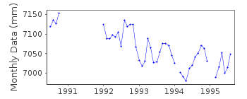
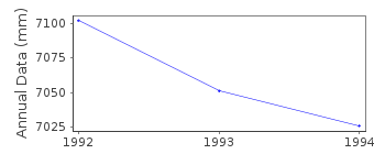
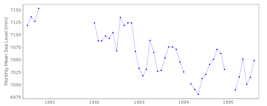
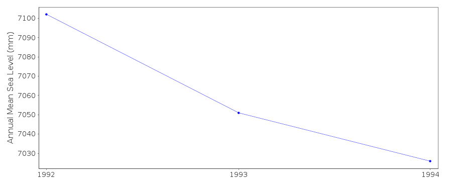
| Time span of data: | 1990 – 1995 |
| Completeness (%): | 63 |
| Date of last update: | 09 Nov 1998 |
| Green Arrow: | Current Station |
| Yellow Marker: | Neighbouring RLR Station |
| Red Marker: | Neighbouring Metric Station |
Please note: In many cases, the station position in our database is accurate to only one minute. Thus, the tide gauge may not appear to be on the coast.
Tide Gauge Data
Additional Data Sources (guide to additional data sources)
Research Quality Data from UHSLC station 216: hourly and dailyStation Documentation
Link to RLR information.Documentation added 1993-03-31
data received from toga officeDocumentation added 1998-11-04
data for 1990 replaced with revised values received from authority 41Data Authority
Hydrographic InstituteRua das Trinas 49
1249-093 Lisboa

![]()
![]()
![]()
