Data
- Obtaining
- Supplying
- High-Frequency
- Bottom Pressure Records
- Other Long Records
- GLOSS/ODINAFRICA Calibration Data
Donate
Donate to PSMSL
Data Notes
- Individual Station Data and Plot Notes
- Referencing the Data Set
- PSMSL Help File
- 2010 Changes to the PSMSL Data Files
Extracted from Database
20 Jul 2026
Station Information
| Station ID: | 2190 |
| Latitude: | -7.29 |
| Longitude: | 72.393333 |
| GLOSS ID: | 26 |
| Coastline code: | 453 |
| Station code: | 5 |
| Country: | BRITISH INDIAN OCEAN TERRITORY |
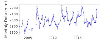
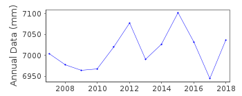
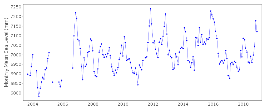
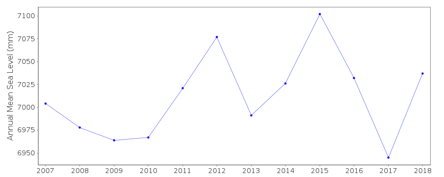
| Time span of data: | 2003 – 2018 |
| Completeness (%): | 86 |
| Date of last update: | 29 Jan 2020 |
| Green Arrow: | Current Station |
| Yellow Marker: | Neighbouring RLR Station |
| Red Marker: | Neighbouring Metric Station |
Please note: In many cases, the station position in our database is accurate to only one minute. Thus, the tide gauge may not appear to be on the coast.
Tide Gauge Data
Additional Data Sources (guide to additional data sources)
Nearby GNSS Stations from SONEL: DGAR, DGAVNearby Real Time Stations from VLIZ: garc
Fast Delivery Data from UHSLC station 104: hourly and daily
Research Quality Data from UHSLC station 104: hourly and daily
Station Documentation
Link to RLR information.Documentation added 2014-01-20
This data was originally loaded onto Diego Garcia C id. 1740. However, this is a completely different gauge which is not levelled into Diego Garcia C so the data were separated.Data Authority
University of Hawaii Sea Level CenterDepartment of Oceanography Division of Natural Sciences
1000 Pope Road
Honolulu
Hawaii 96822

![]()
![]()
![]()
