Data
- Obtaining
- Supplying
- High-Frequency
- Bottom Pressure Records
- Other Long Records
- GLOSS/ODINAFRICA Calibration Data
Donate
Donate to PSMSL
Data Notes
- Individual Station Data and Plot Notes
- Referencing the Data Set
- PSMSL Help File
- 2010 Changes to the PSMSL Data Files
Extracted from Database
13 Jul 2026
Station Information
| Station ID: | 2282 |
| Latitude: | 50.708867 |
| Longitude: | -2.7641 |
| Coastline code: | 170 |
| Station code: | 152 |
| Country: | UNITED KINGDOM |
| Time span of data: | 2008 – 2024 |
| Completeness (%): | 52 |
| Date of last update: | 01 Oct 2025 |
| Green Arrow: | Current Station |
| Yellow Marker: | Neighbouring RLR Station |
| Red Marker: | Neighbouring Metric Station |
Please note: In many cases, the station position in our database is accurate to only one minute. Thus, the tide gauge may not appear to be on the coast.
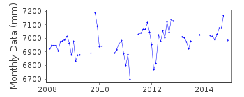
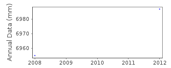
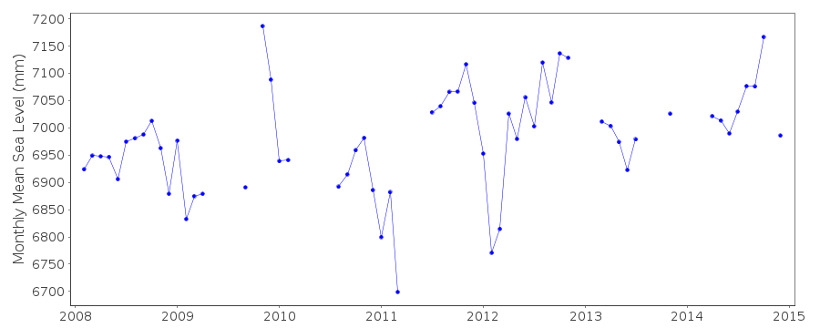
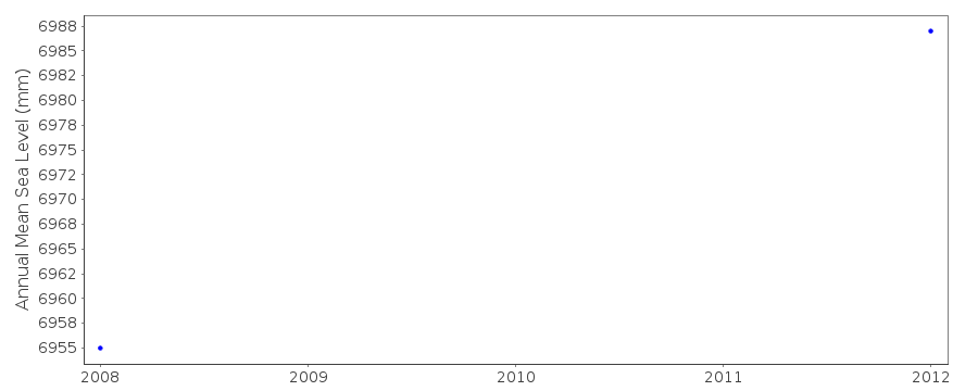
Tide Gauge Data
Station Documentation
Link to RLR information.Documentation added 2016-02-03
West Bay Harbour is a new station operated by the Channel Coastal Observatory (CCO) based at NOC Southampton. Instrument type (2008-2011) was a Rosemount WaveRadar REX. The datum of the data was Ordnance Datum Newlyn (ODN). The Primary benchmark TGBM is 3.951m above ODN. Tide Gauge Zero (TGZ) 2.425m below ODN, 0.175m below Admiralty Chart Datum (ACD)and 6,376m below TGBM. Sampling interval is 10mins. This gauge was replaced by a step gauge in March 2011. The RLR diagram is for the step gauge. ACD is 6.201m below TGBM, ODN is 3.951m below TGBM and Tide Gauge Zero (TGZ) is 0.175m below ACDData Authority
National Oceanography CentreWaterfront Campus
European Way
Southampton

![]()
![]()
![]()
