Data
- Obtaining
- Supplying
- High-Frequency
- Bottom Pressure Records
- Other Long Records
- GLOSS/ODINAFRICA Calibration Data
Donate
Donate to PSMSL
Data Notes
- Individual Station Data and Plot Notes
- Referencing the Data Set
- PSMSL Help File
- 2010 Changes to the PSMSL Data Files
Extracted from Database
13 Jul 2026
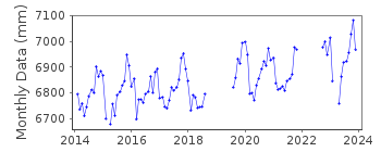
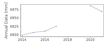
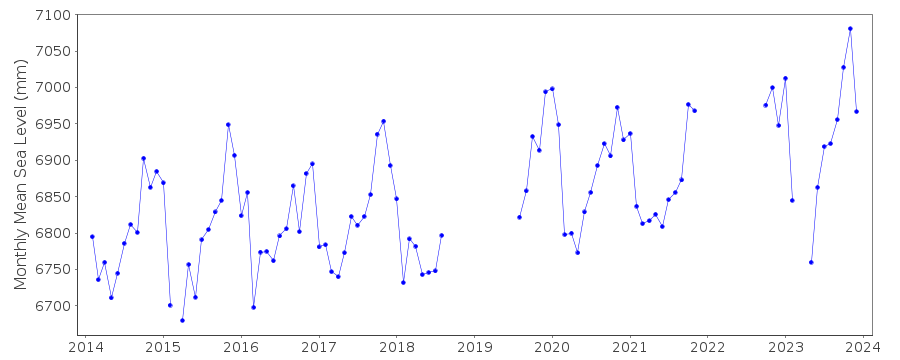
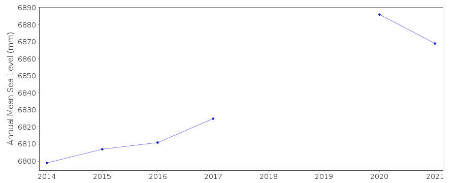
Station Information
| Station ID: | 2416 |
| Latitude: | 54.48862 |
| Longitude: | -0.61462 |
| Coastline code: | |
| Station code: | |
| Country: | UNITED KINGDOM |
| Time span of data: | 2014 – 2024 |
| Completeness (%): | 78 |
| Date of last update: | 01 Oct 2025 |
| Green Arrow: | Current Station |
| Yellow Marker: | Neighbouring RLR Station |
| Red Marker: | Neighbouring Metric Station |
Please note: In many cases, the station position in our database is accurate to only one minute. Thus, the tide gauge may not appear to be on the coast.
Tide Gauge Data
Additional Data Sources (guide to additional data sources)
Nearby Real Time Stations from VLIZ: whitStation Documentation
Link to RLR information.Documentation added 2024-07-16
There is a ‘Whitby’ tide gauge operated by the national tide gauge network, although very close these are not the same. Whitby Harbour is operated by the North East Coastal Observatory (NECO)Data Authority
National Oceanography CentreWaterfront Campus
European Way
Southampton

![]()
![]()
![]()
