Data
- Obtaining
- Supplying
- High-Frequency
- Bottom Pressure Records
- Other Long Records
- GLOSS/ODINAFRICA Calibration Data
Donate
Donate to PSMSL
Data Notes
- Individual Station Data and Plot Notes
- Referencing the Data Set
- PSMSL Help File
- 2010 Changes to the PSMSL Data Files
Extracted from Database
20 Jul 2026
Station Information
| Station ID: | 259 |
| Latitude: | -43.60563 |
| Longitude: | 172.72194 |
| Coastline code: | 690 |
| Station code: | 22 |
| Country: | NEW ZEALAND |
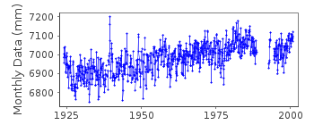
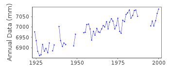
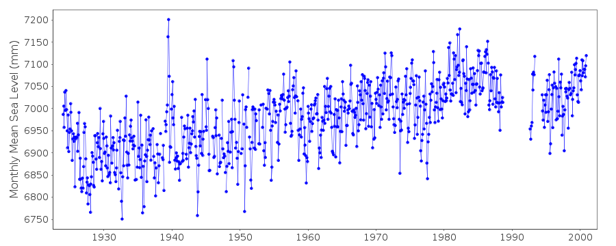
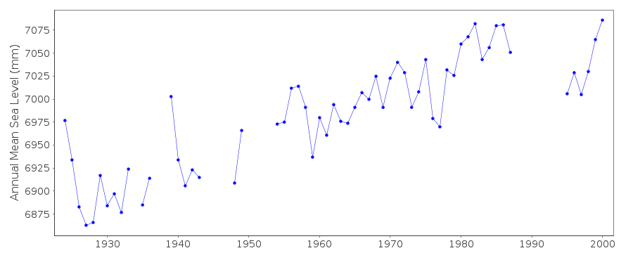
| Time span of data: | 1924 – 2000 |
| Completeness (%): | 89 |
| Date of last update: | 17 Jan 2003 |
| Green Arrow: | Current Station |
| Yellow Marker: | Neighbouring RLR Station |
| Red Marker: | Neighbouring Metric Station |
Please note: In many cases, the station position in our database is accurate to only one minute. Thus, the tide gauge may not appear to be on the coast.
Tide Gauge Data
Additional Data Sources (guide to additional data sources)
Nearby GNSS Stations from SONEL: LYTT, MQZGResearch Quality Data from UHSLC station 667: hourly and daily
Station Documentation
Link to RLR information.Documentation added 1993-07-12
Lyttelton II 690/022 RLR(1970) is 10.1m below BM UD 40Documentation added 2000-04-05
Data for this station come from the work of John Hannah, Journalof Geophysical Research, 95(B8), 12399-12405, 1990.
This is an historic station last data 2000
Documentation added 2003-01-17
New data from John Hannah added 17/01/03 which supercedes old data.New data does not have any missing days information.
Old data has been backed up.
Documentation added 2003-01-17
New data from John Hannah was for Auckland II, Dunedin II,Lyttelton II and Wellington II.
Documentation added 2005-10-17
There is a new John Hannah paper referring to New Zealand data forWellington, Dunedin, Lyttelton and Auckland. The reference is:
"An updated analysis of long-term sea level change in New Zealand."
Geophysical Research Letters, V31, L03307, doi:10.1029/2003GL019166
(2004).
Data Authority
Department of Survey and Land InformationP.O. Box 170
Wellington

![]()
![]()
![]()
