Data
- Obtaining
- Supplying
- High-Frequency
- Bottom Pressure Records
- Other Long Records
- GLOSS/ODINAFRICA Calibration Data
Donate
Donate to PSMSL
Data Notes
- Individual Station Data and Plot Notes
- Referencing the Data Set
- PSMSL Help File
- 2010 Changes to the PSMSL Data Files
Extracted from Database
13 Jul 2026
Station Information
| Station ID: | 270 |
| Latitude: | 29.233333 |
| Longitude: | -81 |
| Coastline code: | 960 |
| Station code: | 6 |
| Country: | UNITED STATES |
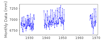
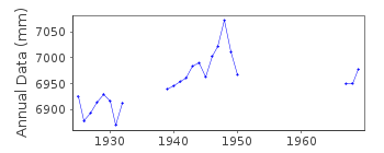
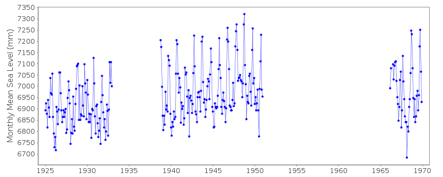
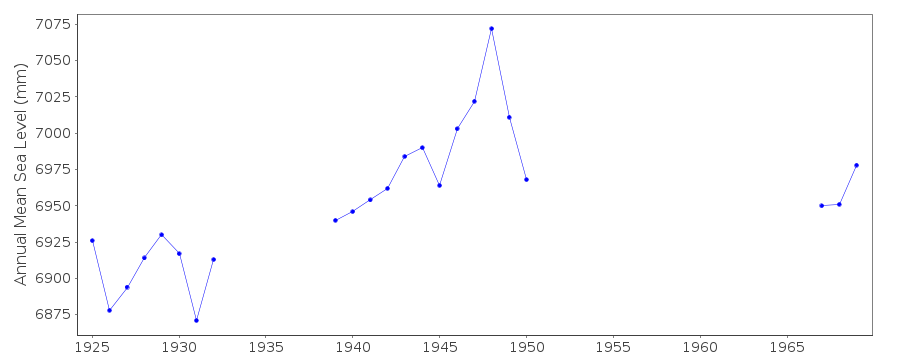
| Time span of data: | 1925 – 1969 |
| Completeness (%): | 53 |
| Date of last update: | 01 Jan 1980 |
| Green Arrow: | Current Station |
| Yellow Marker: | Neighbouring RLR Station |
| Red Marker: | Neighbouring Metric Station |
Please note: In many cases, the station position in our database is accurate to only one minute. Thus, the tide gauge may not appear to be on the coast.
Tide Gauge Data
Station Documentation
Link to RLR information.Documentation added 1991-06-11
Daytona Beach 960/006 RLR(1969) is 12.6m below BM2(1925)Documentation added 1993-07-12
Daytona Beach 960/006 RLR(1969) is 12.6m below BM2(1925)Documentation added 2012-02-16
Daytona Beach is now an Historic station. last data received was that for 1969.There is also a large gap in the data from 1950-66. Daytona Beach is no longer
featured on the NOAA website.
Data Authority
N.O.A.A. / N.O.S.N/oes33, Ssmc4, Room 6531
1305 East-West Highway
Silver Spring,
MD 20910

![]()
![]()
![]()
