Data
- Obtaining
- Supplying
- High-Frequency
- Bottom Pressure Records
- Other Long Records
- GLOSS/ODINAFRICA Calibration Data
Donate
Donate to PSMSL
Data Notes
- Individual Station Data and Plot Notes
- Referencing the Data Set
- PSMSL Help File
- 2010 Changes to the PSMSL Data Files
Extracted from Database
13 Jul 2026
WARNING: QCFLAG EXISTS. PLEASE READ THE DOCUMENTATION.
Station Information
| Station ID: | 320 |
| Latitude: | -32.916667 |
| Longitude: | 151.8 |
| Coastline code: | 680 |
| Station code: | 131 |
| Country: | AUSTRALIA |
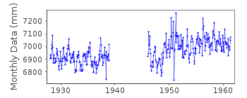
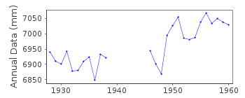
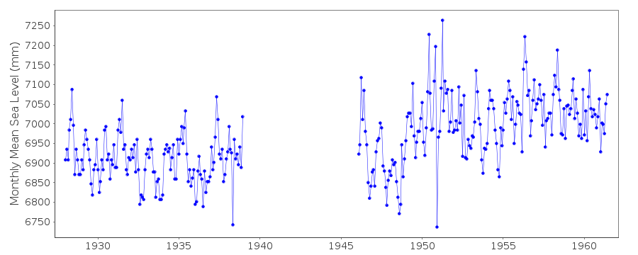
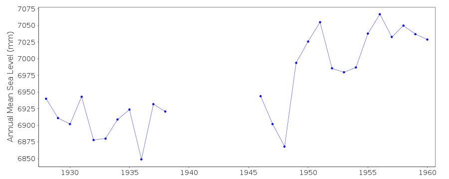
| Time span of data: | 1928 – 1961 |
| Completeness (%): | 78 |
| Date of last update: | 01 Jan 1980 |
| Green Arrow: | Current Station |
| Yellow Marker: | Neighbouring RLR Station |
| Red Marker: | Neighbouring Metric Station |
Please note: In many cases, the station position in our database is accurate to only one minute. Thus, the tide gauge may not appear to be on the coast.
Tide Gauge Data
Station Documentation
Link to RLR information.Documentation added 1991-06-11
Newcastle I 680/131 RLR(1960) is 10.3m below BM no. 1Documentation added 1993-07-29
Apparent large datum shift around 1949. Newcastle 1 is an historic station last data 1961Documentation added 1995-05-02
Station density along some sections of the Australian coast has meant that station codes 601 onwards have been reordered compared to those in earlier versions of the PSMSL data set.Data Authority
Department of Public WorksPhillip Street
Sydney
N.S.W. 2000

![]()
![]()
![]()
