Data
- Obtaining
- Supplying
- High-Frequency
- Bottom Pressure Records
- Other Long Records
- GLOSS/ODINAFRICA Calibration Data
Donate
Donate to PSMSL
Data Notes
- Individual Station Data and Plot Notes
- Referencing the Data Set
- PSMSL Help File
- 2010 Changes to the PSMSL Data Files
Extracted from Database
13 Jul 2026
Station Information
| Station ID: | 41 |
| Latitude: | 42.166667 |
| Longitude: | 41.683333 |
| Coastline code: | 305 |
| Station code: | 21 |
| Country: | GEORGIA |
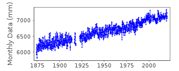
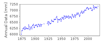
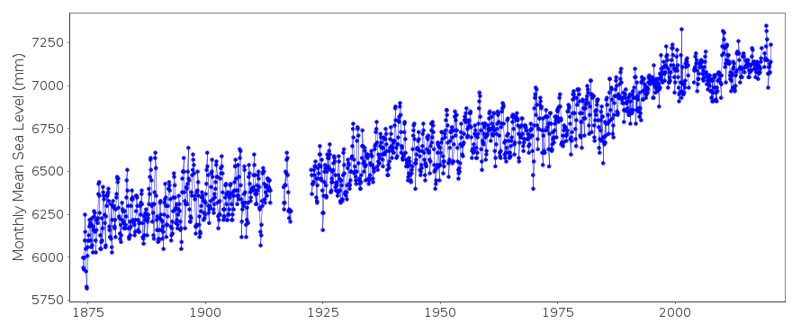
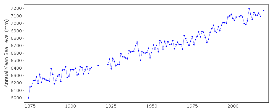
| Time span of data: | 1874 – 2020 |
| Completeness (%): | 94 |
| Date of last update: | 24 Aug 2023 |
| Green Arrow: | Current Station |
| Yellow Marker: | Neighbouring RLR Station |
| Red Marker: | Neighbouring Metric Station |
Please note: In many cases, the station position in our database is accurate to only one minute. Thus, the tide gauge may not appear to be on the coast.
Tide Gauge Data
Station Documentation
Link to RLR information.Documentation added 1993-09-10
1874-1990 FCODE= 3 OR 4; 1924,1926-43, 1949-72 type of bubbler gaugeDocumentation added 1997-11-06
Since 1973 observations from an unspecified tide gaugeDocumentation added 1997-12-10
3 or 4 observations per day are made in days with heavy winds and stormsDocumentation added 1999-03-10
For a discussion on sea level trends along Black Sea coastssee Variations of the Black Sea Level by S.G.Boguslavsky et al.,
Physical Oceanography, 9(3), 199-208, 1998.
Documentation added 1999-03-10
See also comments under Bourgas (code 295/021).Documentation added 2001-07-31
Poti coast subsiding by ~.0056m/yr (letter 20th July 2001).Data Authority
Department of Oceanology and MeteorologyTbilisi State University
Chavchavadze Prospect 1
Tbilisi 38008

![]()
![]()
![]()
