Data
- Obtaining
- Supplying
- High-Frequency
- Bottom Pressure Records
- Other Long Records
- GLOSS/ODINAFRICA Calibration Data
Donate
Donate to PSMSL
Data Notes
- Individual Station Data and Plot Notes
- Referencing the Data Set
- PSMSL Help File
- 2010 Changes to the PSMSL Data Files
Extracted from Database
13 Jul 2026
Station Information
| Station ID: | 614 |
| Latitude: | 39.9 |
| Longitude: | 119.6 |
| Coastline code: | 610 |
| Station code: | 39 |
| Country: | CHINA |
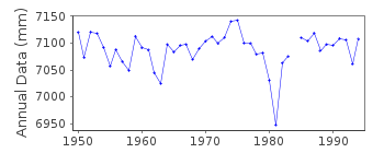
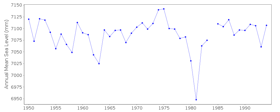
| Time span of data: | 1950 – 1994 |
| Completeness (%): | 99 |
| Date of last update: | 24 Jul 1995 |
| Green Arrow: | Current Station |
| Yellow Marker: | Neighbouring RLR Station |
| Red Marker: | Neighbouring Metric Station |
Please note: In many cases, the station position in our database is accurate to only one minute. Thus, the tide gauge may not appear to be on the coast.
Tide Gauge Data
Station Documentation
Link to RLR information.Documentation added 1991-06-11
Qinhuangdao 610/039 RLR(1980) is 11.4m below BM(1965.7)Documentation added 1993-07-14
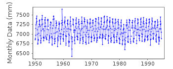
High value for August 1959 and low value for January 1963 noted but no explanation availableDocumentation added 1993-10-19
December 1981 value low, queried with authority Qinhuangdao is an historic station last data 1994Data Authority
National Marine Data and Information Service (NMDIS)No. 93 Liuwei Road
Tianjin 300171

![]()
![]()
![]()
