Data
- Obtaining
- Supplying
- High-Frequency
- Bottom Pressure Records
- Other Long Records
- GLOSS/ODINAFRICA Calibration Data
Donate
Donate to PSMSL
Data Notes
- Individual Station Data and Plot Notes
- Referencing the Data Set
- PSMSL Help File
- 2010 Changes to the PSMSL Data Files
Extracted from Database
13 Jul 2026
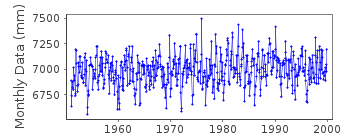
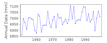
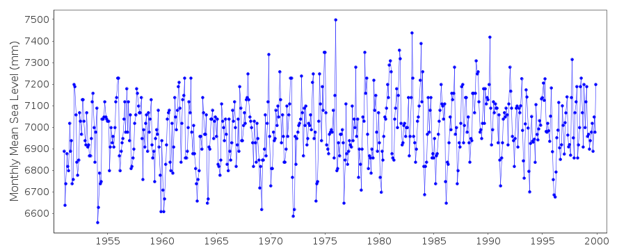
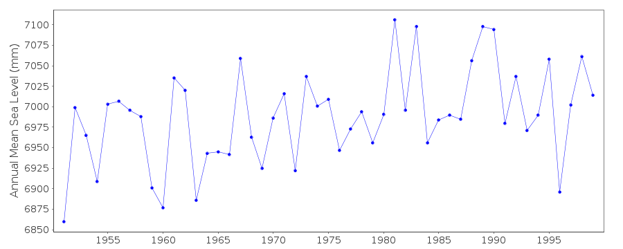
Station Information
| Station ID: | 644 |
| Latitude: | 54.583333 |
| Longitude: | 16.866667 |
| Coastline code: | 110 |
| Station code: | 57 |
| Country: | POLAND |
| Time span of data: | 1951 – 1999 |
| Completeness (%): | 100 |
| Date of last update: | 19 Oct 2001 |
| Green Arrow: | Current Station |
| Yellow Marker: | Neighbouring RLR Station |
| Red Marker: | Neighbouring Metric Station |
Please note: In many cases, the station position in our database is accurate to only one minute. Thus, the tide gauge may not appear to be on the coast.
Tide Gauge Data
Station Documentation
Link to RLR information.Documentation added 1992-08-27
Former German name for Ustka was Stolpmunde.Documentation added 1997-02-06
Data for 1977 and 1987 revised in February 1997Documentation added 2000-03-03
Ustka 110/057 RLR(1997) is 11.4m below BM HM. Due to changes in data policy within Poland the last data we have for 1999Data Authority
Inst. for Meteorology and Water ManagementMaritime Branch
Ul. Waszyngtona 42
PL-81-342 Gdynia

![]()
![]()
![]()
