Data
- Obtaining
- Supplying
- High-Frequency
- Bottom Pressure Records
- Other Long Records
- GLOSS/ODINAFRICA Calibration Data
Donate
Donate to PSMSL
Data Notes
- Individual Station Data and Plot Notes
- Referencing the Data Set
- PSMSL Help File
- 2010 Changes to the PSMSL Data Files
Extracted from Database
13 Jul 2026
Station Information
| Station ID: | 693 |
| Latitude: | 27.916667 |
| Longitude: | -110.9 |
| Coastline code: | 830 |
| Station code: | 31 |
| Country: | MEXICO |
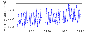
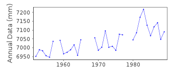
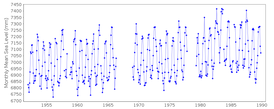
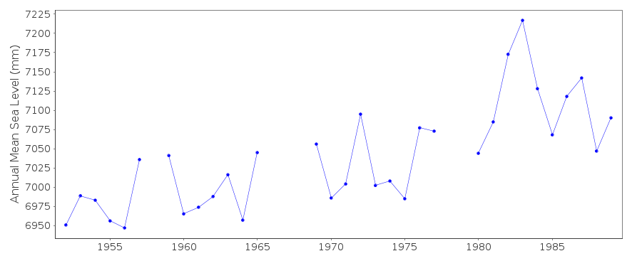
| Time span of data: | 1952 – 1989 |
| Completeness (%): | 87 |
| Date of last update: | 14 May 2013 |
| Green Arrow: | Current Station |
| Yellow Marker: | Neighbouring RLR Station |
| Red Marker: | Neighbouring Metric Station |
Please note: In many cases, the station position in our database is accurate to only one minute. Thus, the tide gauge may not appear to be on the coast.
Tide Gauge Data
Additional Data Sources (guide to additional data sources)
Research Quality Data from UHSLC station 397: hourly and dailyStation Documentation
Link to RLR information.Documentation added 1991-06-11
Guaymas 830/031 RLR(1964) is 9.0m below BM1Guaymas is an historic station RLR data ends in 1988 whereas 'Metric' data ends in 1989. Data plot through to 1989 looks correct. Therefore the RLR factor has been applied through to the end of the dataset. Whole dataset is now RLR
Documentation added 1997-01-30
Large earthquake offshore of Mexico about 19 degrees North on 9 October 1995 with large tsunami generated. See article by A.E.Filonov in EOS, 78(3), 1997.Data Authority
Servicio Mareografico NacionalInstituto de Geofisica, Ciudad Universitaria
Delegacion de Coyoacan
04510 Mexico D.F.

![]()
![]()
![]()
