Data
- Obtaining
- Supplying
- High-Frequency
- Bottom Pressure Records
- Other Long Records
- GLOSS/ODINAFRICA Calibration Data
Donate
Donate to PSMSL
Data Notes
- Individual Station Data and Plot Notes
- Referencing the Data Set
- PSMSL Help File
- 2010 Changes to the PSMSL Data Files
Extracted from Database
13 Jul 2026
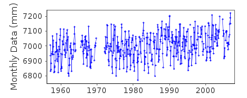
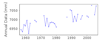
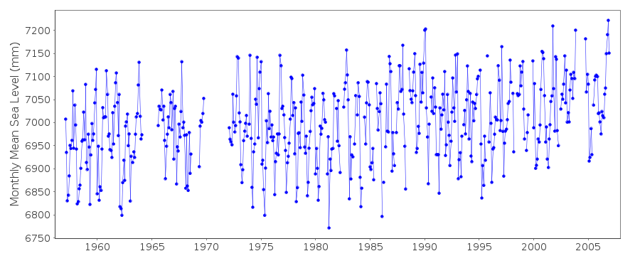
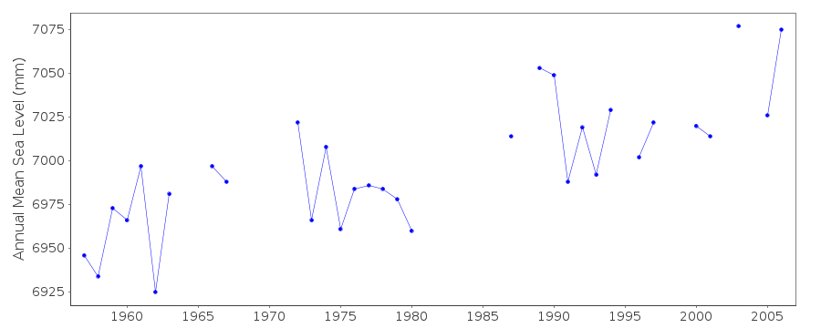
Station Information
| Station ID: | 839 |
| Latitude: | 62.016667 |
| Longitude: | -6.766667 |
| GLOSS ID: | 237 |
| Coastline code: | 15 |
| Station code: | 11 |
| Country: | FAROE ISLANDS |
| Time span of data: | 1957 – 2006 |
| Completeness (%): | 84 |
| Date of last update: | 30 Oct 2007 |
| Green Arrow: | Current Station |
| Yellow Marker: | Neighbouring RLR Station |
| Red Marker: | Neighbouring Metric Station |
Please note: In many cases, the station position in our database is accurate to only one minute. Thus, the tide gauge may not appear to be on the coast.
Tide Gauge Data
Additional Data Sources (guide to additional data sources)
Nearby GNSS Stations from SONEL: ARGI, TORSStation Documentation
Link to RLR information.Documentation added 1991-06-11
Torshavn 015/011 RLR(1966) is 9.3m below BMK-87-9030Documentation added 1992-04-08
Some BM uncertaainty before 1963Documentation added 1992-07-07
Prior to 1991 fcode=24Documentation added 1993-07-12
Torshavn 015/011 RLR(1966) is 9.3m below BM K-87-9030Data Authority
Det Danske Meteorologiske InstitutObservation Department, Operations Division
Lyngbyvej 100
DK-2100 Kobenhavn

![]()
![]()
![]()
