Data
- Obtaining
- Supplying
- High-Frequency
- Bottom Pressure Records
- Other Long Records
- GLOSS/ODINAFRICA Calibration Data
Donate
Donate to PSMSL
Data Notes
- Individual Station Data and Plot Notes
- Referencing the Data Set
- PSMSL Help File
- 2010 Changes to the PSMSL Data Files
Extracted from Database
13 Jul 2026
Station Information
| Station ID: | 922 |
| Latitude: | 27.826667 |
| Longitude: | -97.05 |
| Coastline code: | 940 |
| Station code: | 4 |
| Country: | UNITED STATES |
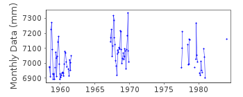
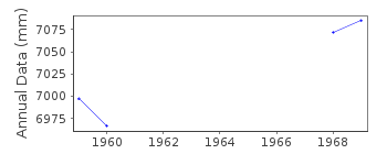
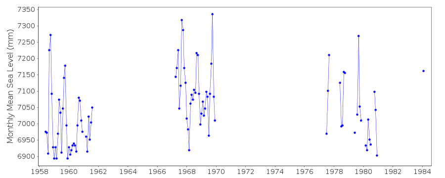
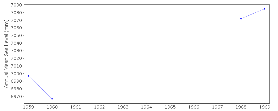
| Time span of data: | 1958 – 1984 |
| Completeness (%): | 28 |
| Date of last update: | 03 Jun 1987 |
| Green Arrow: | Current Station |
| Yellow Marker: | Neighbouring RLR Station |
| Red Marker: | Neighbouring Metric Station |
Please note: In many cases, the station position in our database is accurate to only one minute. Thus, the tide gauge may not appear to be on the coast.
Tide Gauge Data
Additional Data Sources (guide to additional data sources)
Nearby GNSS Stations from SONEL: ARP5, ARP7, ARP3Station Documentation
Link to RLR information.Documentation added 1991-06-11
Port Aransas 940/004 RLR(1959) is 9.0m below BM10Documentation added 1993-07-29
Many stations on the Gulf coast have large values for September 1961.Documentation added 2012-02-15
Port Aransas is an Historic station.Last data received was that for 1984. Primary benchmark on the original RLR diagram was BM 10 3.511m above TGZ this no longer appears in the NOAA documentation. Last Primary benchmark was NO 11 1960 4.42m above TGZ.Data Authority
N.O.A.A. / N.O.S.N/oes33, Ssmc4, Room 6531
1305 East-West Highway
Silver Spring,
MD 20910

![]()
![]()
![]()
