Data
- Obtaining
- Supplying
- High-Frequency
- Bottom Pressure Records
- Other Long Records
- GLOSS/ODINAFRICA Calibration Data
Donate
Donate to PSMSL
Other Links
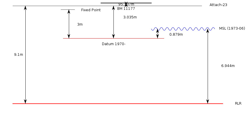
Revised Local Reference (RLR) Diagram for OGA
Station ID: 1264

If the image above appears blurry, or you would like to see a larger image, please view the full-sized image of the RLR diagram.
Datum information
Add 6.065m to all data values to refer to RLR
RLR is 104.237m below primary benchmark BM 11177
Ellipsoidal information from SONEL (explanation)
| GNSS | Solution | Height | Velocity | Epoch | GNSS Start | GNSS End | Distance |
|---|---|---|---|---|---|---|---|
| P104 | NGL14 | 30.691 ± 0.004 | 2.33 ± 0.77 | 2020.0000 | 2003-06-02 | 2023-03-23 | 242 |
| P104 | GT3 | 30.699 ± 0.005 | 2.35 ± 0.30 | 2020.0000 | 2003-06-02 | 2023-03-23 | 242 |


