Data
- Obtaining
- Supplying
- High-Frequency
- Bottom Pressure Records
- Other Long Records
- GLOSS/ODINAFRICA Calibration Data
Donate
Donate to PSMSL
Other Links
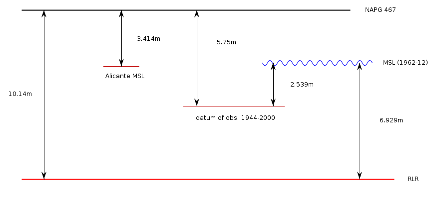
Revised Local Reference (RLR) Diagram for LA CORUÑA I
Station ID: 484

If the image above appears blurry, or you would like to see a larger image, please view the full-sized image of the RLR diagram.
Datum information
Add 4.390m to all data values to refer to RLR
RLR is 10.140m below primary benchmark NAPG 467
Ellipsoidal information from SONEL (explanation)
| GNSS | Solution | Height | Velocity | Epoch | GNSS Start | GNSS End | Distance |
|---|---|---|---|---|---|---|---|
| ACOR | ULR7a | 47.501 ± 0.007 | -2.05 ± 0.22 | 2020.0000 | 1998-12-11 | 2023-03-22 | 479 |
| ACOR | NGL14 | 47.496 ± 0.005 | -2.48 ± 0.37 | 2020.0000 | 1998-12-11 | 2023-03-22 | 479 |
| ACOR | GT3 | 47.498 ± 0.006 | -1.56 ± 0.30 | 2020.0000 | 1998-12-11 | 2023-03-22 | 479 |
| ACOR | JPL14 | 47.499 ± 0.004 | -2.15 ± 0.19 | 2020.0000 | 1998-12-11 | 2023-03-22 | 479 |


